
Plan from the South Sedona area
Our home is near Outbound Sedona Resort, placing guests close to SR 179 and the Chapel area. These are typical drive-time ranges from that neighborhood, not turn-by-turn directions from the rental.
Allow extra time for weekend traffic, weather, trailhead parking, and seasonal road conditions.
Broken Arrow Trailhead
5-10 minAn easy early-morning option near the south side of Sedona.
Cathedral Rock Trailhead
15-20 minCheck active shuttle operations and trailhead restrictions before departure.
Bell Rock Vista
15-20 minA straightforward SR 179 drive for base trails and wide-open views.
Devil's Bridge access
25-35 minDry Creek access takes longer; confirm the current shuttle route and trailhead plan.
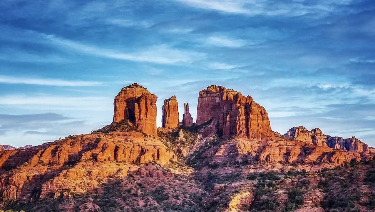
One of Sedona's most iconic trails leading to stunning viewpoints. Best for sunset photography.
Trail Information
Difficulty: Moderate
Best Time: Late afternoon for sunset colors
Parking: Cathedral Rock Trailhead (Red Rock Pass required)
Tips
- • Bring plenty of water
- • Some scrambling required near the top
- • Very exposed - avoid during midday heat
- • Popular spot - arrive early or late afternoon
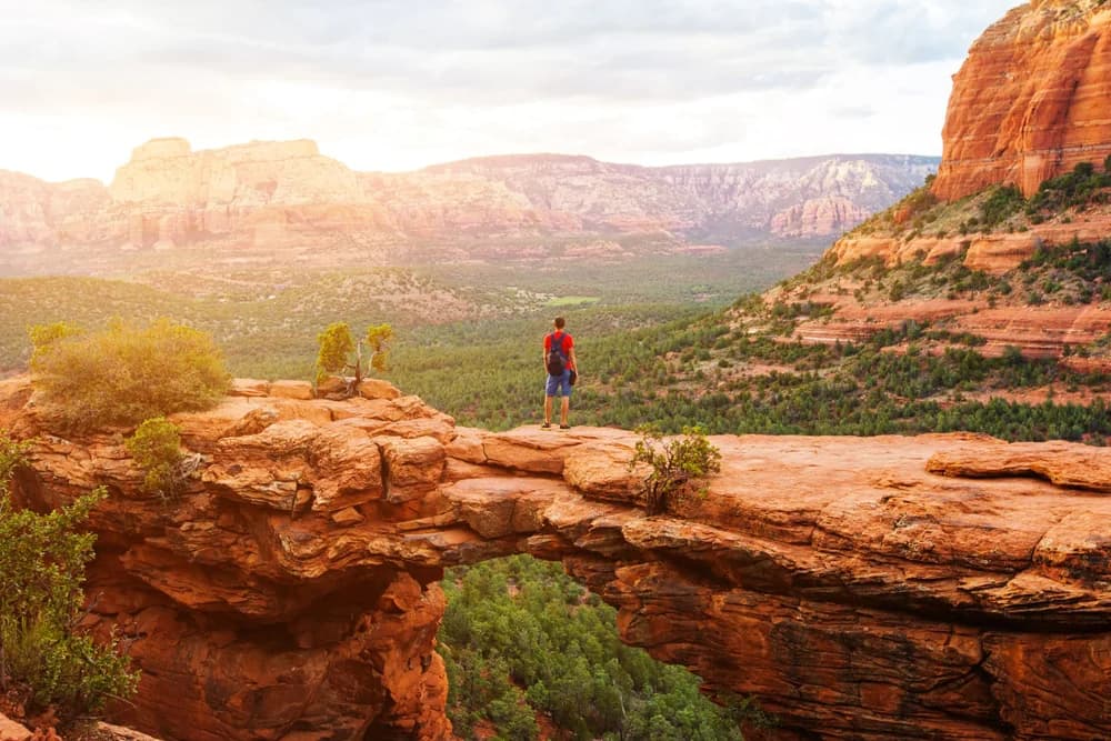
Sedona's largest natural stone arch. Popular photo spot with dramatic views.
Trail Information
Difficulty: Moderate
Best Time: Early morning or late afternoon
Parking: Devil's Bridge Trailhead or Dry Creek Vista
Tips
- • Long wait times for photos on the bridge
- • First mile is on a dirt road
- • Start early to avoid crowds
- • Moderate climb at the end

Prominent landmark and vortex site with panoramic views. Multiple trail options.
Trail Information
Difficulty: Easy to Moderate
Best Time: Sunrise or sunset
Parking: Bell Rock Vista Trailhead
Tips
- • Well-marked trails at the base
- • Vortex meditation spot
- • Good for families
- • Beautiful morning light

Beautiful box canyon with diverse scenery and a powerful vortex site.
Trail Information
Difficulty: Moderate
Best Time: Morning for cooler temperatures
Parking: Boynton Canyon Trailhead
Tips
- • Shaded in many areas
- • Rich cultural history
- • Look for ancient ruins
- • Great bird watching

360-degree views of Sedona and excellent sunset viewing location.
Trail Information
Difficulty: Moderate
Best Time: Sunset
Parking: Airport Mesa Trailhead
Tips
- • Exposed trail - bring sun protection
- • Popular sunset spot
- • Known vortex location
- • Rocky in some sections
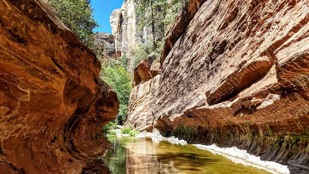
Shaded creek-side trail with multiple water crossings. Perfect for hot days.
Trail Information
Difficulty: Easy
Best Time: Year-round, spectacular in fall
Parking: Call of the Canyon Trailhead
Tips
- • 13 creek crossings
- • Great for hot summer days
- • Beautiful fall colors
- • Bring water shoes
Hiking Safety Tips
Essential Items
- • Water (1 liter per hour of hiking)
- • Sun protection (hat, sunscreen, sunglasses)
- • Proper footwear with good traction
- • Navigation tools (map, GPS device)
- • First aid kit
- • Snacks and electrolytes
Safety Guidelines
- • Check weather before heading out
- • Start early to avoid afternoon heat
- • Stay on marked trails
- • Hike with a partner when possible
- • Turn back if conditions are unsafe
- • Inform someone of your hiking plans
Book Your Sedona Getaway
Reserve your stay at our beautiful Sedona vacation rental. Check availability and book directly with us for the best rates and personalized service.